FALCOTRAIL
10 · 21 · 30 · 52 km
3,019m
4
About this event
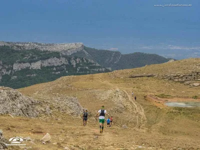
The FALCOTRAIL winds through the rugged Sierra del Quípar in southeastern Spain, starting beneath the historic Roman arch in Cehegín. Four distances cater to different abilities, from a welcoming 10-kilometre route with 451 metres of climbing to the flagship 52-kilometre challenge that tackles 3,019 metres of elevation, including the demanding ascent of Pico del Águila. The middle distances — 21 kilometres with 1,218 metres of climbing and 30 kilometres with 1,985 metres — venture deeper into technical terrain where steep climbs open onto expansive views over the Murcian hills. All routes finish back through the Roman arch, blending ancient history with wild mountain scenery. The supportive atmosphere and varied distance options make this late-November event accessible to newcomers while still testing experienced trail runners.
Distances
| Distance | Elevation | Level |
|---|---|---|
| 10km | 451m | Beginner |
| 21km | 1,218m | Intermediate |
| 30km | 1,985m | Advanced |
| 52km | 3,019m | Advanced |
Find the races you'd actually enter
Free. Takes a minute.
- Connect Strava — see races that match what you run
- Create a group and plan this race together
- Share a ride to the start line
- Save it and track your season
Race data from ITRA
More events like this
See all
TRAILSERIES LES ERMITES - ULLDEMOLINS
Trail Las Palomas
TRAILSERIES COLLDEJOU